blah blah blah
The Scaur
Length: 4.4 miles out-and-backDifficulty (click for info): Easy
Elevation Gain: 630 feet (+90 feet on return)
Rating (click for info): 6/10
Elevation: 2231'
Prominence: 39'
Driving Directions:
Trailhead and parking area are West Branch Road in Waterville Valley, NH. From Exit 28 on Rt. 93, drive 10.2 miles northeast on Rt. 49 and turn left onto Tripoli Road (signs for Waterville Valley Ski Area). In 1.2 miles, bear right to avoid the ski area entrance and continue 0.6 miles down Tripoli Road. Turn right onto West Branch Road, cross a bridge, and immediately bear left into the parking area. Click here for a Google map.
About the Hike:
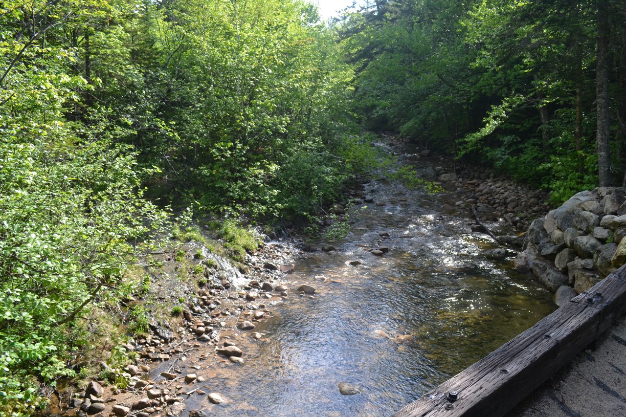
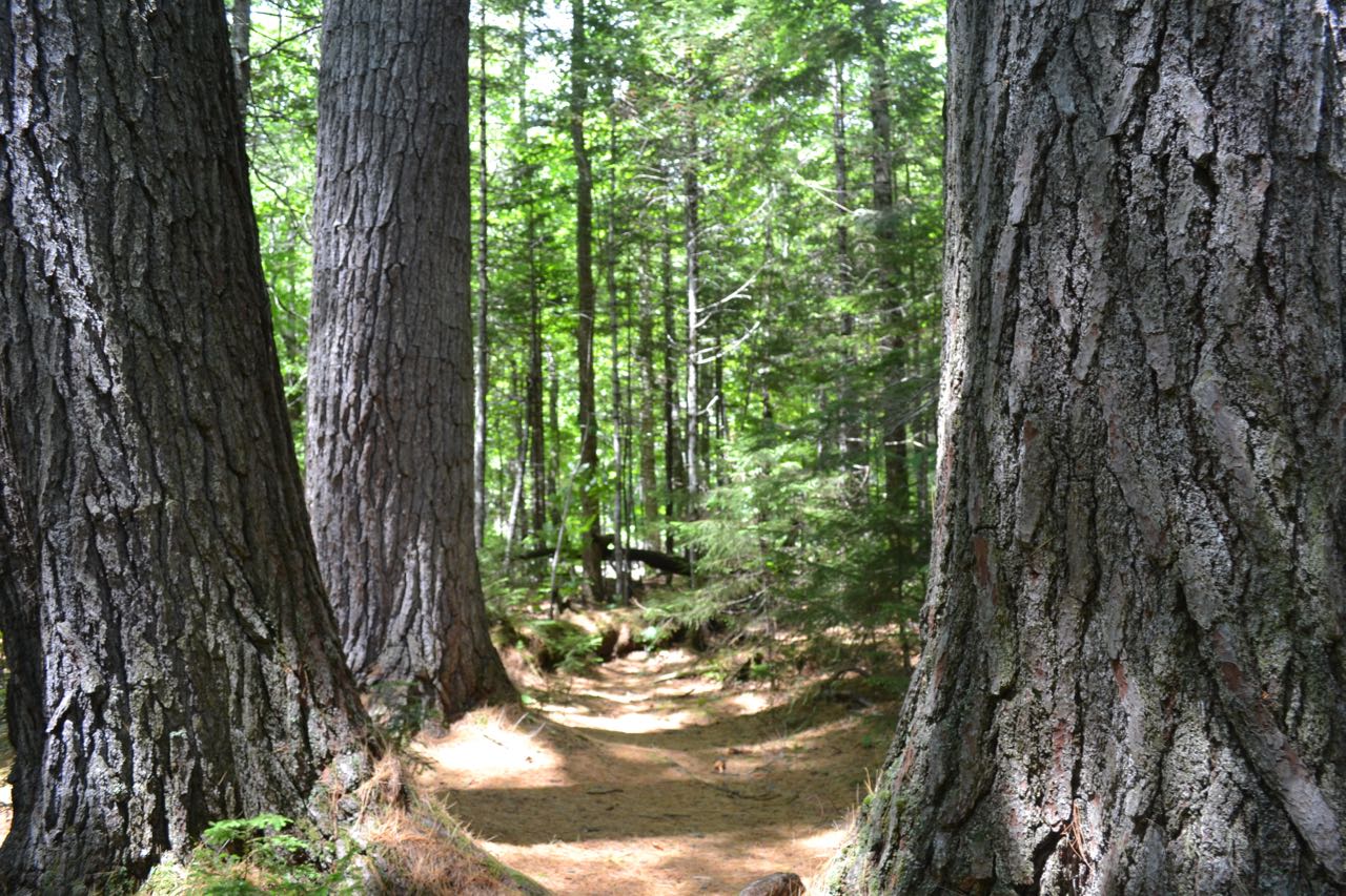
The rocky outcrop on Scaur Peak's long west ridge known as The Scaur provides fine views of Waterville Valley for not much more than a long walk. On the way, you'll enjoy the scenery on the multi-use Livermore Trail, including brooks, wildflowers (in the spring), and the "Big Pines". Start from the kiosk at the east end of the parking area and walk out to a junction. Turn left onto the flat, graded Livermore Trail, marked as Livermore Road on the cross-country ski trail signs. An easy walk of 0.3 miles leads out to a grassy clearing. Descend to pass another multi-use trail and cross a brook on a bridge, passing by Greeley Ponds Trail. In a short distance, the trail crosses Mad River on another bridge. Next, Boulder Path leaves on the right toward Snows Mountain and the trail soon passes an impressive boulder in Avalanche Brook, far below (walk a short distance down Boulder Path to get closer to it). Soon, Big Pines Path leaves on the left. This spur trail leads 0.2 miles down to a stand of pine trees near the Mad River. This side trip is included in the hike mileage.
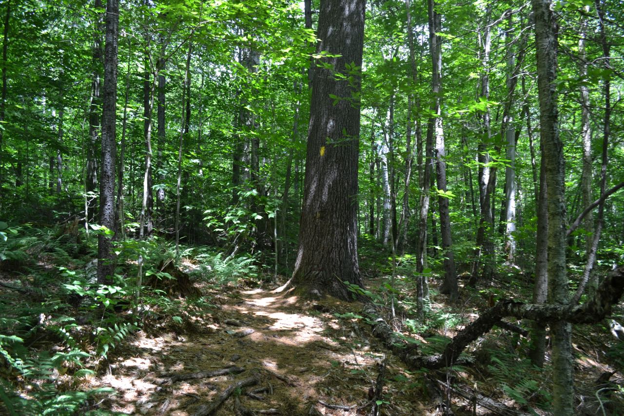
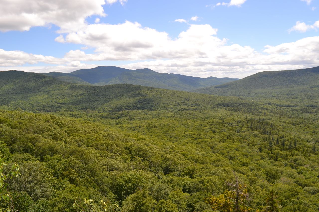
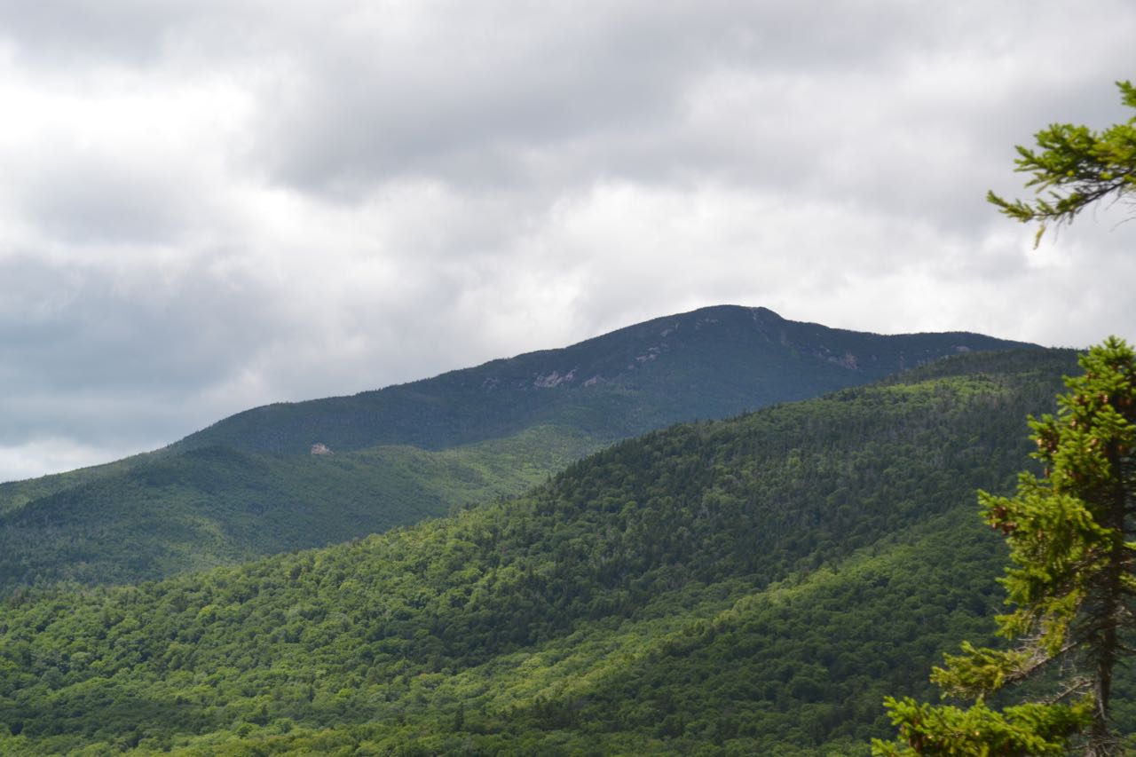
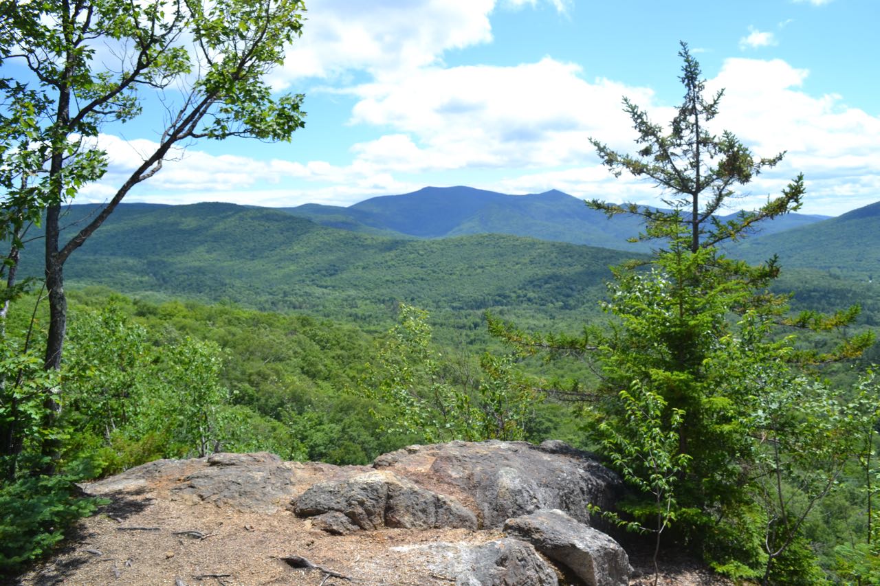
In 0.2 miles, turn left onto Irene's Path. This trail starts out level, then angles up a hillside, climbing easily for a while before flattening out again. In 0.9 miles from Livermore Trail, the trail takes a sharp right turn at a former trail junction, then climbs more steeply for 0.2 miles. It then makes its way around to a rock face behind The Scaur. The main trail continues along this rock face; to access The Scaur, turn right just before it onto a spur trail. Climb moderately, with one rock scramble, for a short distance out to the viewpoint ledge. Here, you will find a wide view over Waterville Valley to Sandwich Dome. To the far left, above the trees, are Middle and South Tripyramid. To the right and below is the long ridge of Snows Mountain, which blocks the view of the town. To the right of Sandwich Dome is Mt. Tecumseh and its ski area. By exploring the north side of the knob, you can find a viewpoint of Mt. Osceola and Thornton Gap, with the cliffs of East Osceola in full view.
Printable directions page